navigational aids
Open source systems
Nowadays any boat obviously has at least one chart plotter. Whether it’s a hi-tech top off the bill system or a tablet / smartphone. I’m not gonna go into the pro’s and cons of all the different options.
 What I like to share here is what I used during my crossing and what I use ever since as a portable backup on deliveries.
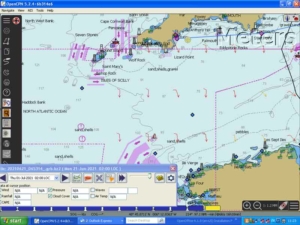
I have a Panasonic CF-19 Toughbook. It’s an older one but still going strong since I only use it as my sailing laptop. I use that with an external GPS mouse and an (RX) Ais antenna. On it runs OpenCPN and ZyGrib.
OpenCPN and zyGrib*) are both freeware software with a track record of decades. Over the years both have been developed to a serious and very professional level. There is also a quite active OpenCPN Facebook user group.
One of the advantages of OpenCPN in combination with zyGrib is that you can overlay the gribfiles on your plotter. Especially for the bigger picture on the development and movement of Hi’s and Low’s, I find that very helpful.
For downloading gribfiles offshore, I use an iridium Sat Phone. Usually I download the gribfiles every three days which gives a quite accurate picture.
I kept this equipment as a backup system and took it on several deliveries. One time the AIS on the delivery boat wasn’t too stable, another time the both of the plotters on the delivery boat died.
Emergency calls
It might not be generally known, but a Sat Phone works the same as a normal (smart)phone. Meaning if you’re out of minutes, you can still call the emergency number. As long as you keep the battery charged that is!
*) zyGrib is now replaced by a newer version called XyGrib

